Dirty Epic Route Map
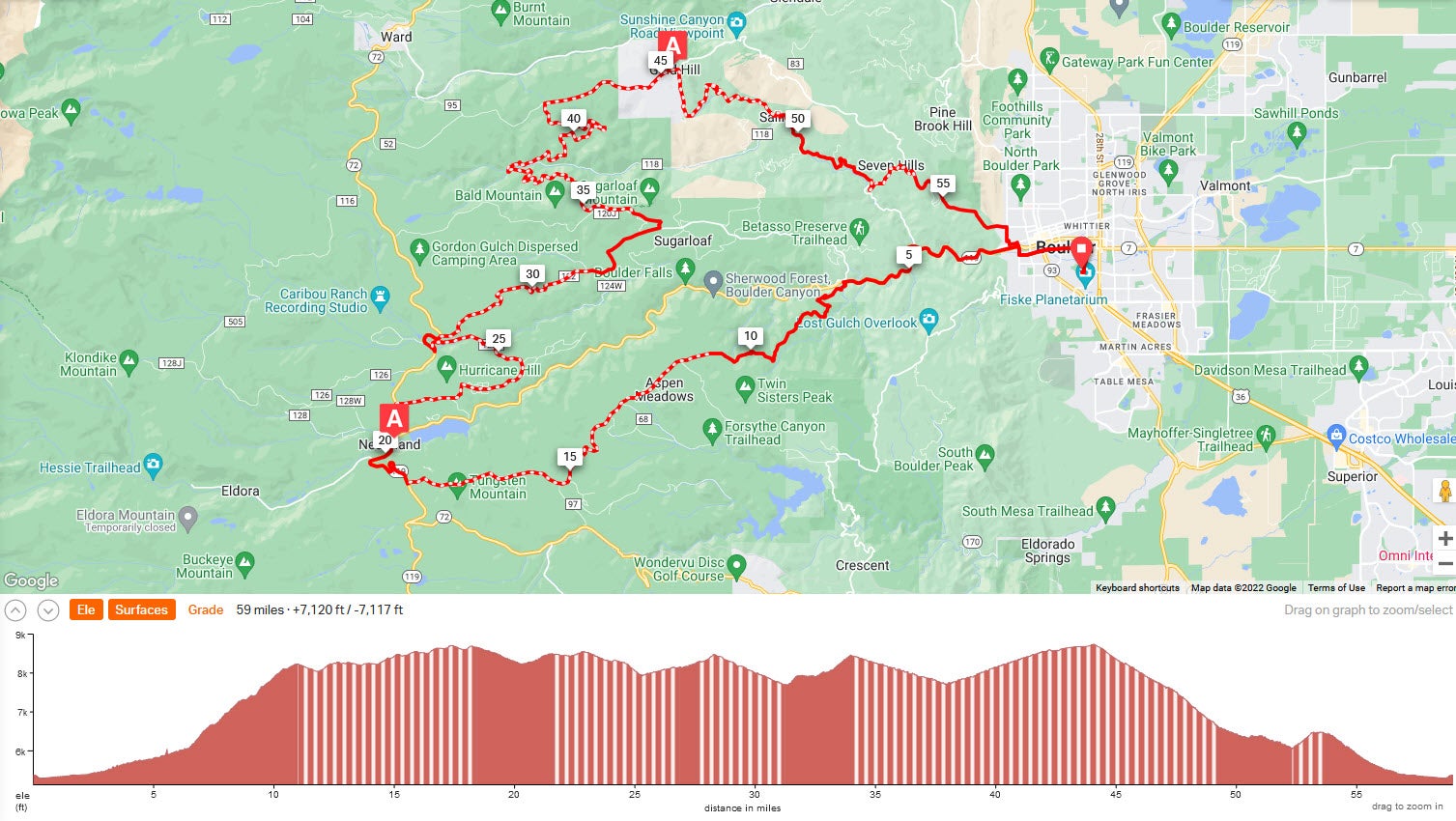
The Dirty Epic begins at the CU campus at 7:00am with a peloton lead out down Folsom Ave., Arapahoe Ave., and 6th St. to Canyon Ave. The Boulder Canyon section is be closed to uphill vehicle traffic until you turn left turn onto Magnolia Road near mile 6. The beginning of Magnolia Rd. is very steep, averaging over 9% for the first few miles, with some sections nearing 20%. Your bicycle will need good climbing gears. The gravel section of Magnolia (miles 11-18) is in excellent condition. The first aid station is near mile 20 in Nederland at Tin Shed Sports. From there the route is a mix of road and gravel, and joins the Switzerland Trail via Sugarloaf Rd. Switzerland Trail descends to Sunset (miles 34-38) and then climbs (miles 38-45) to the second aid station at Gold Hill. Switzerland Trail includes some technical rocky sections, so we suggest a minimum of a 40c tire. From Gold Hill, the route returns to the start/finish on campus via Boulder St., Gold Run Rd., Four Mile Canyon Dr., Poorman Rd., and Sunshine Canyon Dr. Once in Boulder, return to campus via 4th St, Pearl St., 6th St., Arapahoe Ave., and Folsom Ave. The Dirty Epic route is 59 miles, with 33 miles of gravel and 7000 feet of climbing.
Click on the map image below to view the full map on the RideWithGPS website. Download PDF map with aid station locations and turn by turn directions.